
|
Eta Data Assimilation System (EDAS40) Archive InformationArchive began: January 1, 2004Archive ended: December 31, 2018 NOAA-Air Resources Laboratory 5830 University Research Court College Park, MD 20740 ACCESSThe EDAS40 archive may be accessed by a ftp client or by a web browser: 1) If you want to use a ftp client, Windows PC users may use WinSCP, FileZilla, etc. that support passive mode. MacOS and Linux users may use the ftp command. Connect your ftp client to ftp.arl.noaa.gov using anonymous and your email address for the username and password, respectively and change directory to /archives/edas40. Note if you are using multiple ftp connections, limit the number of concurrent connections equal to or less than two. Otherwise, your access to our ftp server may be blocked off. 2) If you are using a web browser, point it to https://www.ready.noaa.gov/data/archives/edas40. It may take a few minutes or longer for the webpage to display.EDAS ARCHIVE OVERVIEWThe National Weather Service's National Centers for Environmental Prediction (NCEP) runs a series of computer analyses and forecasts operationally. One of the operational systems is the EDAS (Eta Data Assimilation System), covering the U.S. Addition current information on this model can be found on NCEP's website ( https://www.nco.ncep.noaa.gov/pmb/products/ ). At NOAA's Air Resources Laboratory (ARL), NCEP model data are used for air quality transport and dispersion modeling. ARL archives both EDAS and FNL data using a 1-byte packing routine. Both archives contain basic fields such as the u- and v-wind components, temperature, and humidity. However, the archives differ from each other because of the horizontal and vertical resolution, as well as in the specific fields, provided by NCEP.ORIGIN OF THE DATA The 3-hourly archive data come from NCEP's EDAS. (Note: information here may not be up to date. Check the NCEP website for current information.) The EDAS was implemented into the operational early Eta model runs during 1995. The EDAS is an intermittent assimilation system consisting of successive 3-h Eta model forecasts and Optimum Interpolation (OI) analyses for a pre-forecast period (12-h for the early Eta) on a 38 level, 48 km grid. A 6-h forecast from the GDAS is used to to start the assimilation at 12-h prior to model start time. The following is a schematic for the 12Z cycle
  6-h GDAS    | 3-h eta | 3-h eta | 3-h eta | 3-h eta |  48-h Eta
------------> |-------->|-------->|-------->|-------->|------------------....-->
Forecast      |  fcst   |  fcst   |   fcst  |   fcst  |  forecast
                 00Z       03Z       06Z       09Z       12Z
where;
|
| = Eta OI analysis
|
The 3-h analysis updates allow for the use of high frequency observations, such as wind profiler, NEXRAD, and aircraft data. ARL saves the successive 3-hour analyses, twice each day to produce a continuous data archive. Some fields such as precipitation and surface fluxes are not available in the analysis files, therefore these are taken from the successive 3-hour forecast files. The 48 km data are interpolated to a 40 km, Lambert Conformal Grid, covering the continental United States.
ARL PROCESSING The ARL archiving program produces a 3 hourly, 40 km dataset on pressure surfaces. In addition, 14 gridpoints on the western end of the model domain and 10 gridpoints on the northern end of the domain are removed to reduce the size of the semi-monthly files (currently at about 627 Mbytes). The data are put into semi-monthly files and made available online at ARL's FTP server (ftp://ftp.arl.noaa.gov/pub/archives/edas40/ ) for easy access via ftp. DATA DESCRIPTION The archive data file contains the data in synoptic time sequence, without any missing records (missing data is represented by nulls and the forecast hour is set to negative 1). Therefore it is possible to position randomly to any point within a data file. Each file contains data for approximately two weeks: days one through 15, and 16 through the end of the month. At each time period, an index record is always the first record, followed by surface data, and then all data in each pressure level from the ground up. EDAS data are available in the files called edas.mmmyy.00#, where mmm is the month (e.g. jul) and yy is the year (97) and 00# refer to:
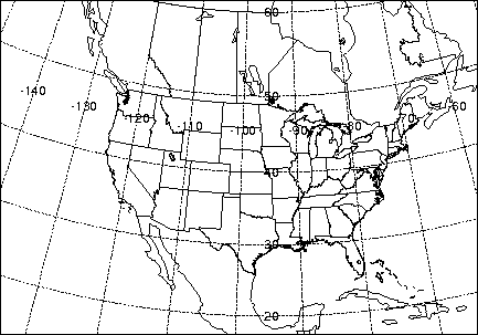
00#=001 - days 1-15 of the month Data Grid The data are on a 185 by 129 Lambert Conformal grid (Fig. 1- EDAS grid domain). In Table 1, the data grid is identified by the model that produced the data, a grid identification number, the number of X and Y grid points, the Pole position (latitude and longitude) of the grid projection, a reference latitude and longitude, the grid spacing (km) which is true at the reference point, the orientation with respect to the reference longitude, the angle between the axis and the cone, and a point on the grid in grid units and latitude and longitude . The given pole position results in the lowest left grid point to have a value of (1,1). Table 1. Data Grid Specifications
Table 2. Meteorological Fields contained in the EDAS Archive.
* geopotential meters Meteorological Fields and Vertical Structure The archived data files contain only some of the fields normally produced by the model at NCEP. These fields were selected according to what is most relevant for transport and dispersion studies and disk space limitations. In Table 2, the fields are identified by a description, the units, and a unique four character identification label that is written to the header label (see Data Grid Unpacking Procedure in a later section) of each record. Data order in the file is given by a two digit code. The first digit indicates if it is a surface (or single) level variable (S) or an upper level variable (U). The second digit indicates the order in which that variable appears in the file. The upper level EDAS data are output on the following 26 pressure surfaces. Table 3 gives the level number corresponding to each data level, which is also written to each header label. Table 3. Description of Vertical Levels
Missing Data Missing data are written as an array of nulls (> =) with a forecast hour of -1 in the header label. The associated field label is defined as "NULL". Definition File The definition file given in Appendix A summarizes the grid specifications and data fields. The format is such that the first 20 characters are the dummy ID field followed by the data. Much of the information is written into the index record of each time period.
Record 1 consists of a four character string that identifies the source of the meteorological data.
The key to reading the meteorological files is decoding the ASCII index record, the first record of each time period. The first 50 characters of the index record contain the same "header" information as do the other records in the given time period. The four-character label is "INDX". The format for this record is given below. Complete descriptions are similar to the variables in the discussion above of the Definition File. Format of the Index Record
END LEVEL AND VARIABLE LOOPS Data Grid Unpacking NCEP typically saves their model output in GRIB format. However, at ARL the data are stored in a more compact form and can be directly used on a variety of computing platforms with direct access I/O. The data array is packed and stored into one-byte characters. To preserve as much data precision as possible, the difference between adjacent grid point=s values is saved and packed rather than the actual values. The grid is then reconstructed by adding the differences between grid values starting with the first value, which is stored in unpacked ASCII form in the header record at grid point (1,1). To illustrate the process, assume that a grid of real data, R, of dimensions i,j is given by the below example.
  1,j       2,j        ....    i-1,j       i,j
  1,j-1     2,j-1      ....    i-1,j-1     i,j-1
  ....      ....       ....    ....        ....
  1,2       2,2        ....    i-1,2       i,2
  1,1       2,1        ....    i-1,1       i,1
The packed value, P, is then given by
Pi,j = (Ri,j - Ri-1,j)* (2**(7-N)),
where the scaling exponent
N = ln dRmax / ln 2 .
The value of dRmax is the maximum difference between any two adjacent grid points for the entire array. It is computed from the differences along each i index holding j constant. The difference at index (1,j) is computed from index (1,j-1), and at 1,1 the difference is always zero. The packed values are one byte unsigned integers, where values from 0 to 126 represent -127 to -1, 127 represents zero, and values of 128 to 254 represent 1 to 127. Each record length is then equal in bytes to the number of array elements plus 50 bytes for the header label information. The 50 byte label field precedes each packed data field and contains the following ASCII data:
*Forecast hour is -1 for missing data. Sample Program A sample FORTRAN90 program is available from the ARL ftp server ( ftp://ftp.arl.noaa.gov/pub/archives/utility/chk_data.f ) that can be used to unpack and read the first few elements of the data array for each record of an ARL packed meteorological file. Appendix A. Definition File - EDAS.CFG
|
||||||||||||||||||||||||||||||||||||||||||||||||||||||||||||||||||||||||||||||||||||||||||||||||||||||||||||||||||||||||||||||||||||||||||||||||||||||||||||||||||||||||||||||||||||||||||||||||||||||||||||||||||||||||||||||||||||||||||||||||||||||||||||||||||||||||||||||||||||||||||||||||||||||||||||||||||||||||||||||||||||||||||||||||||||||||||||||||||||||||||||||||||||||||||||||||||||||||||||
|
|
|||||||||||||||||||||||||||||||||||||||||||||||||||||||||||||||||||||||||||||||||||||||||||||||||||||||||||||||||||||||||||||||||||||||||||||||||||||||||||||||||||||||||||||||||||||||||||||||||||||||||||||||||||||||||||||||||||||||||||||||||||||||||||||||||||||||||||||||||||||||||||||||||||||||||||||||||||||||||||||||||||||||||||||||||||||||||||||||||||||||||||||||||||||||||||||||||||||||||||||
