
Forecast Trajectory Maps for the Southeast United States Updated on Tue Jul 21 02:55:51 UTC 2026
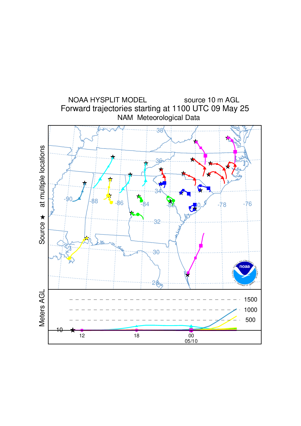
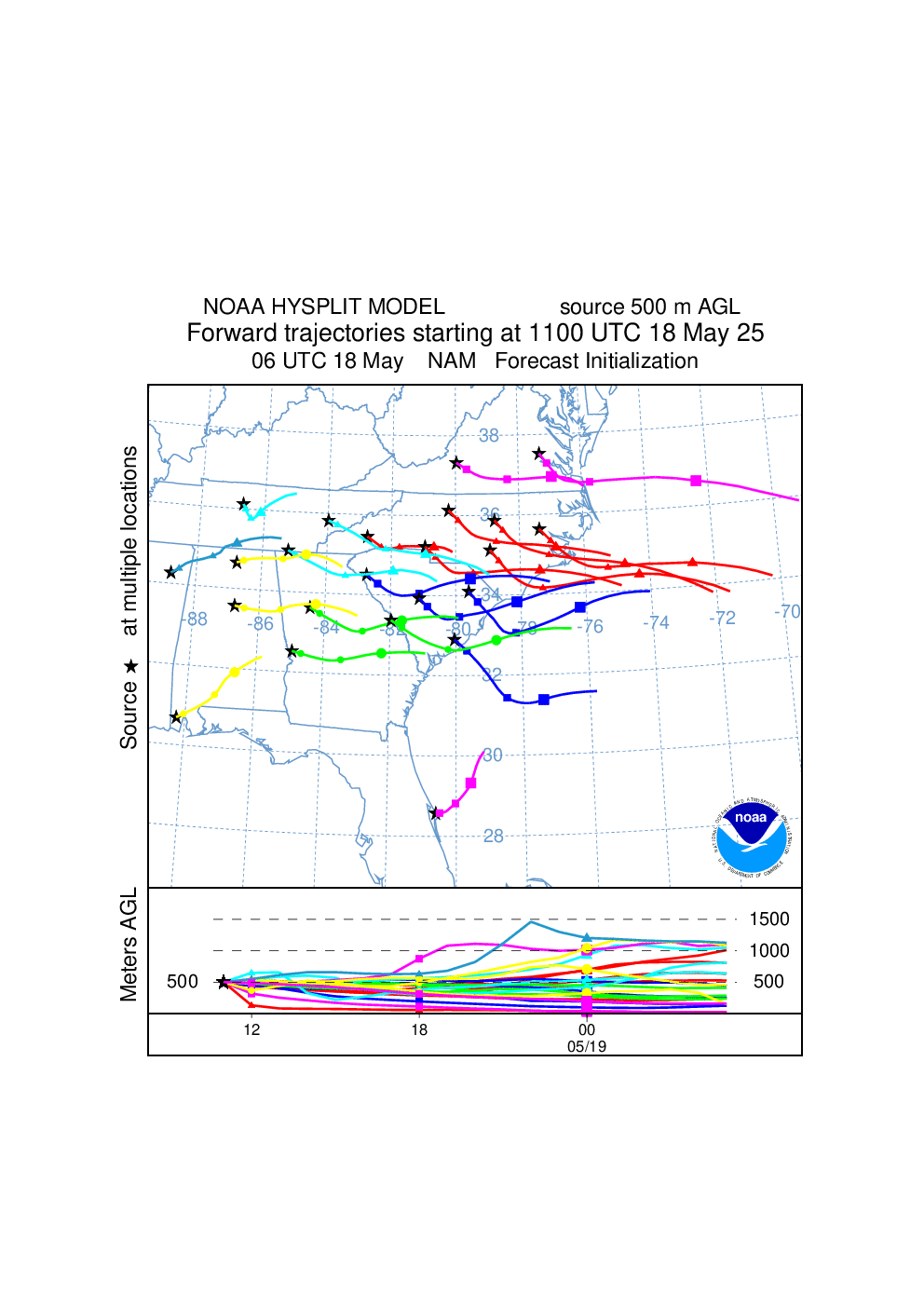
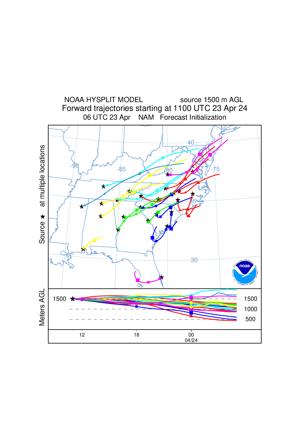
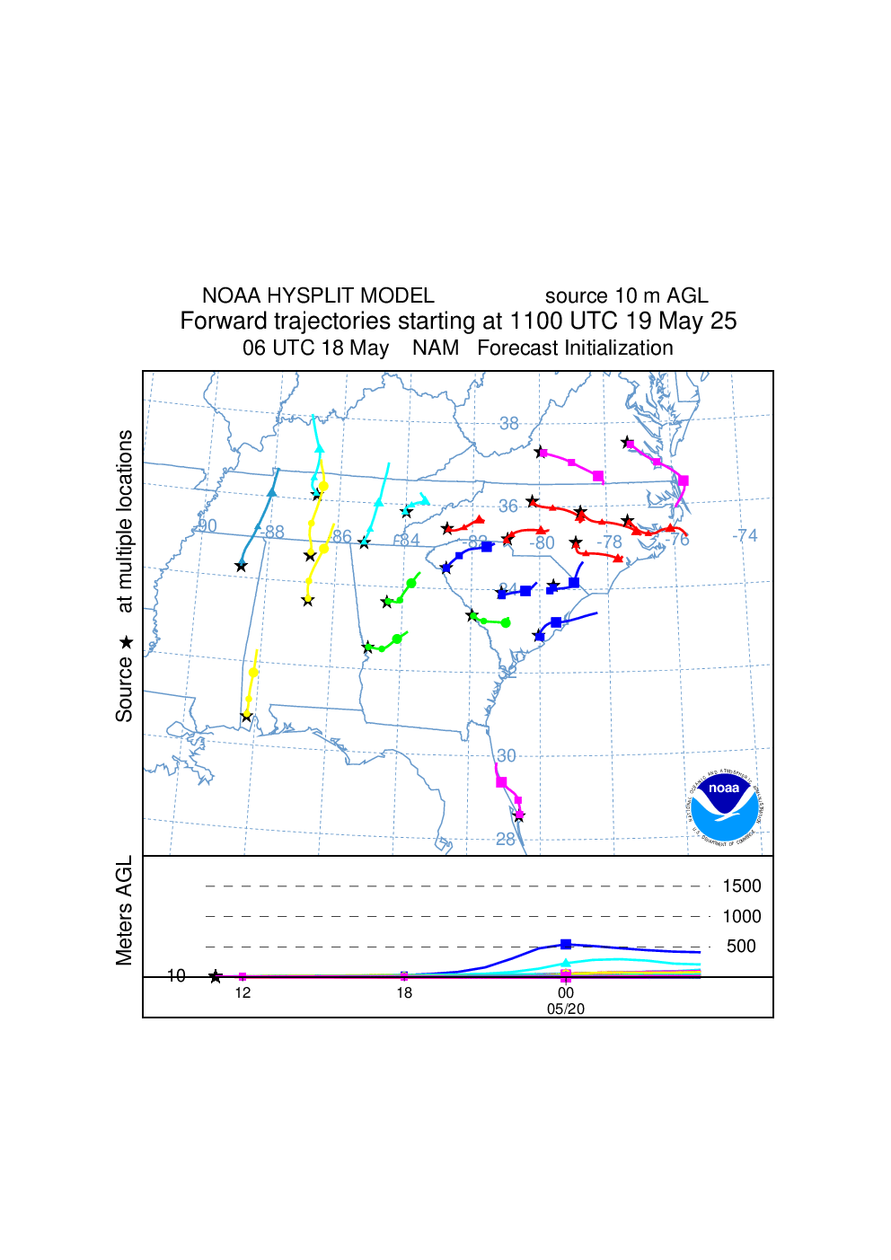
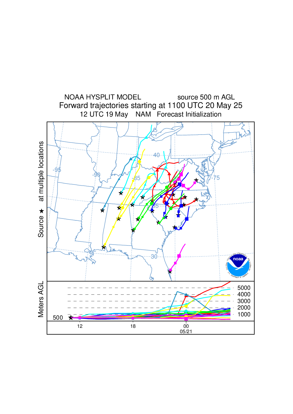
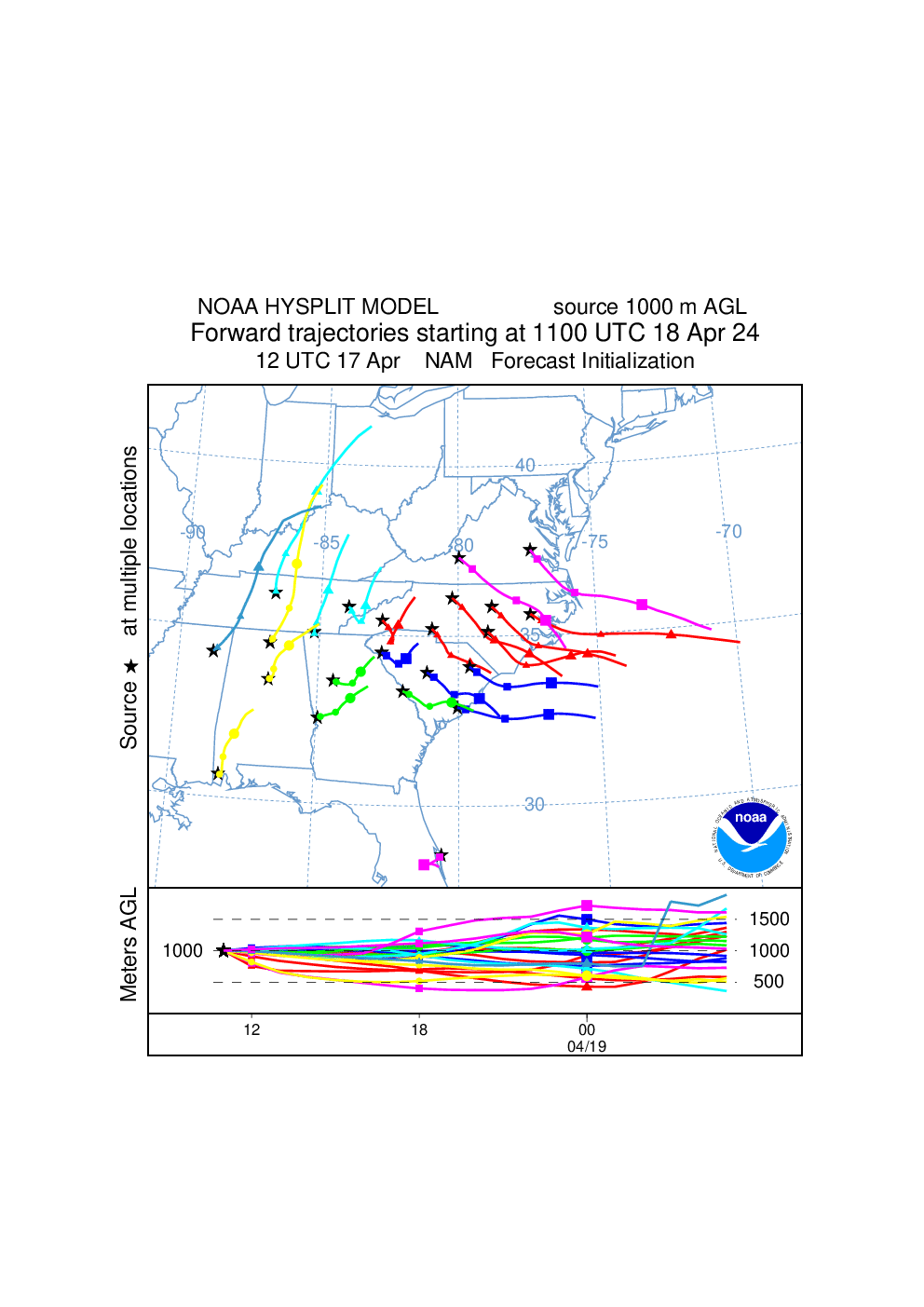
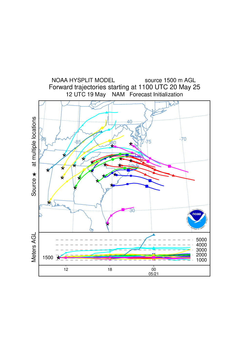
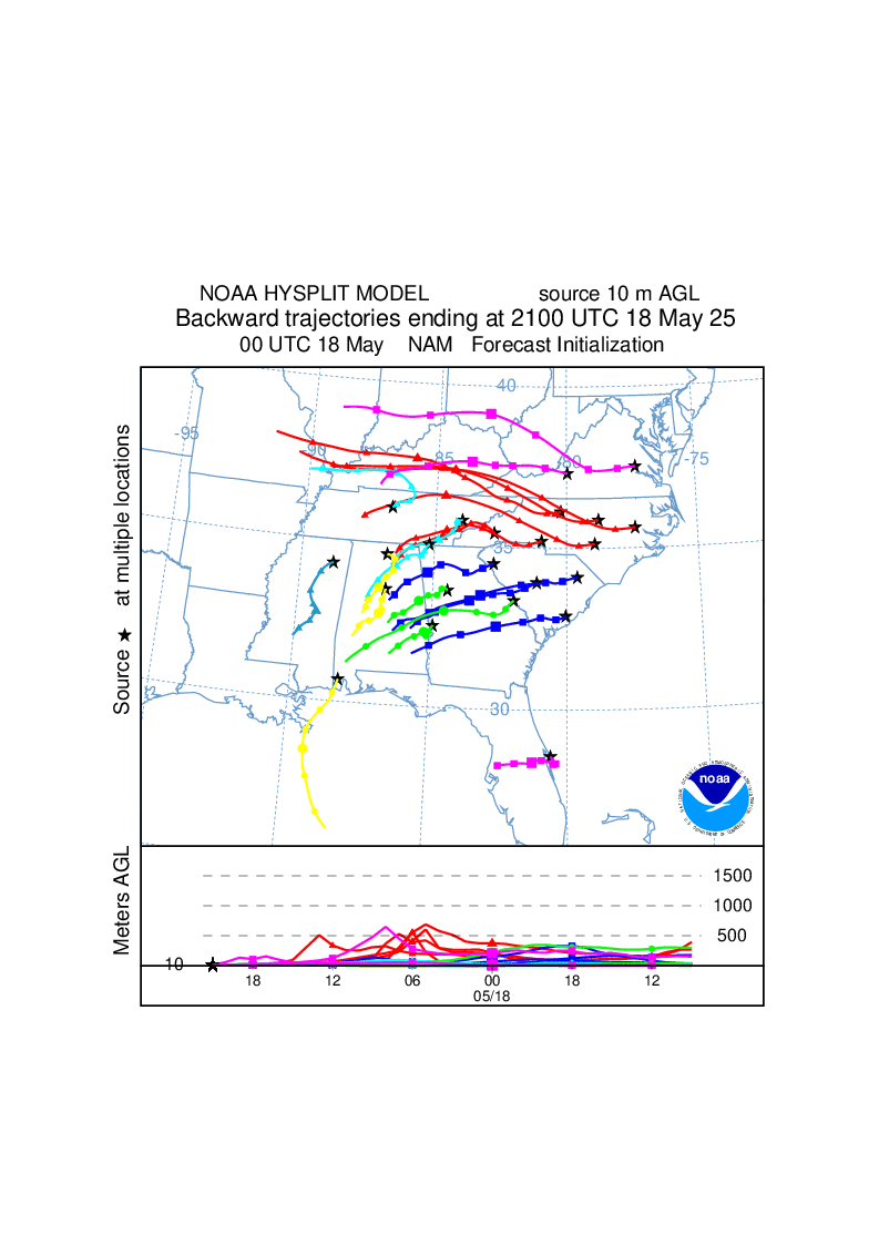
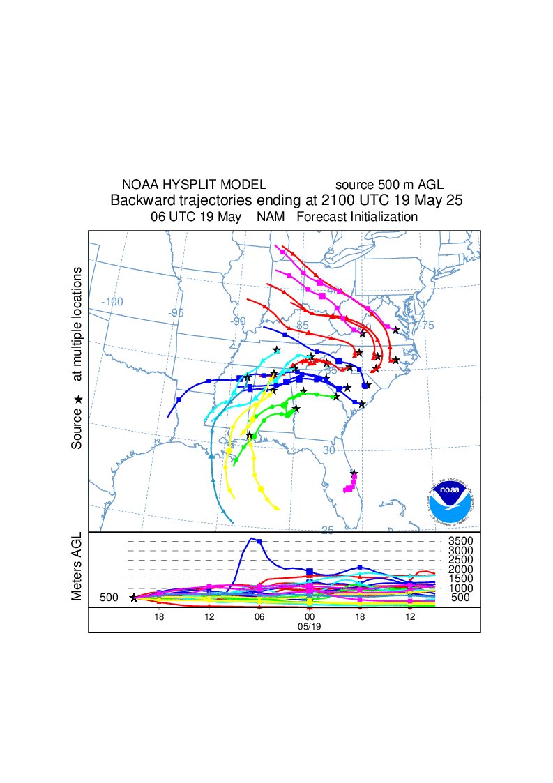
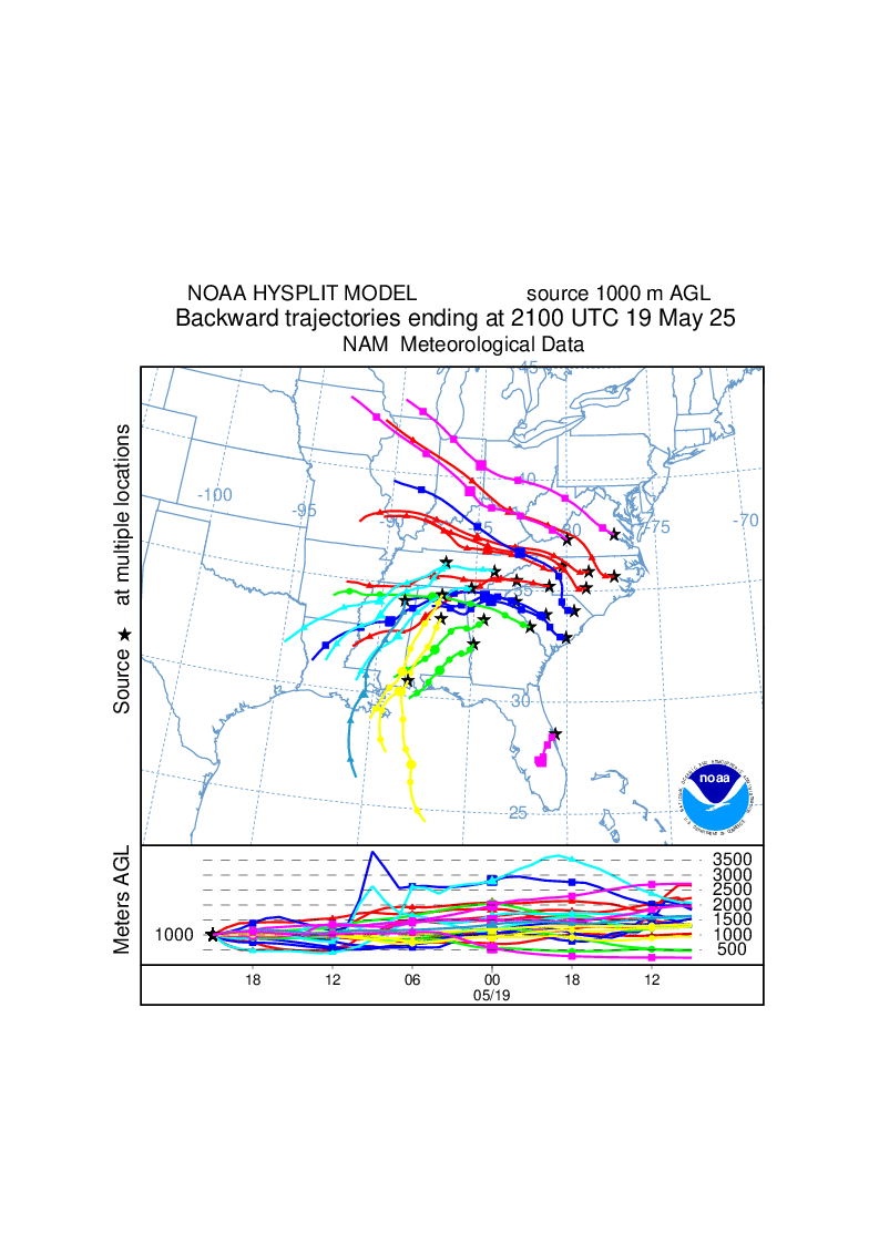
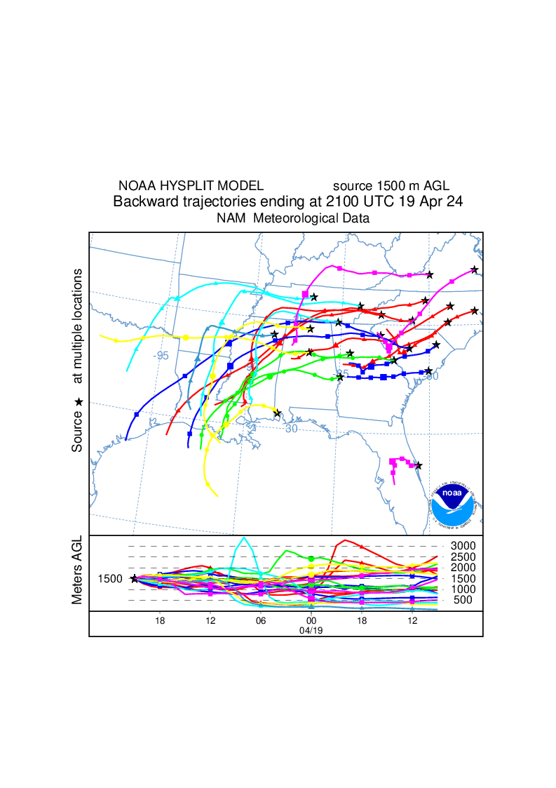
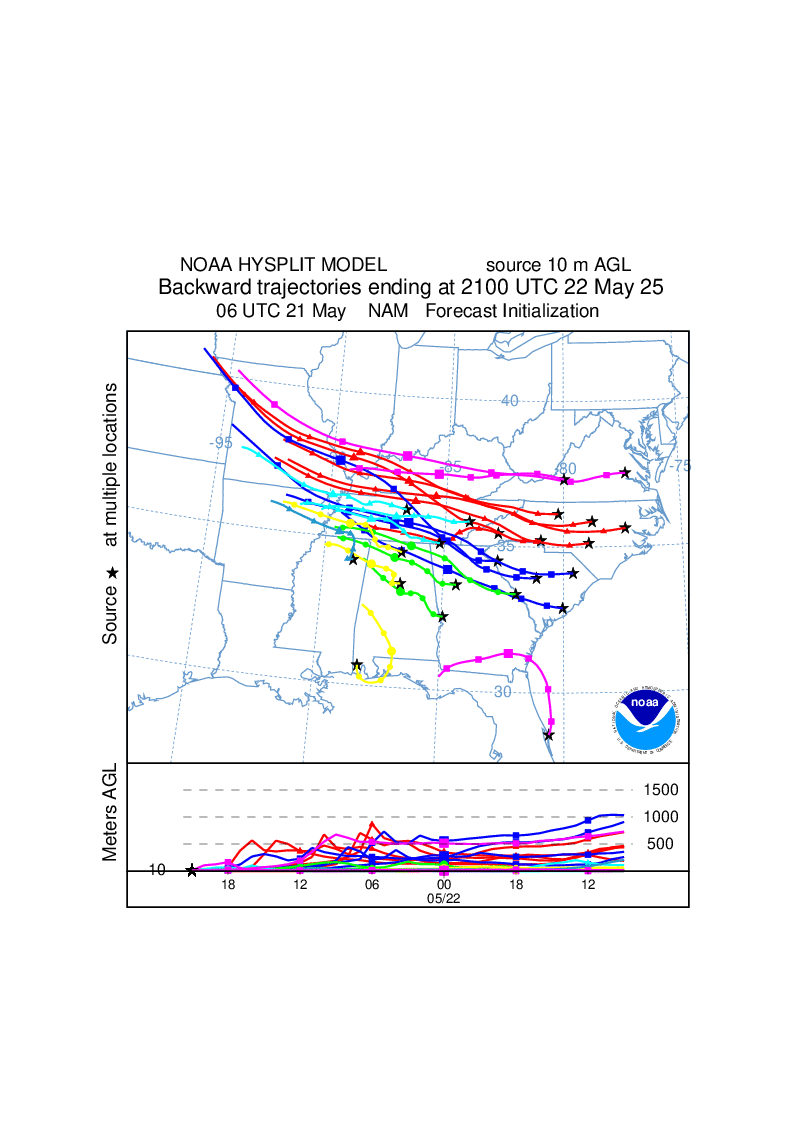
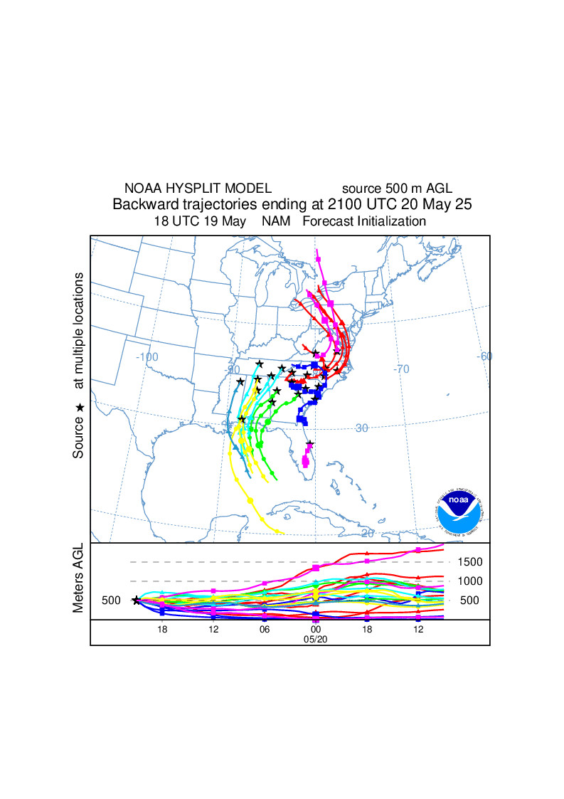
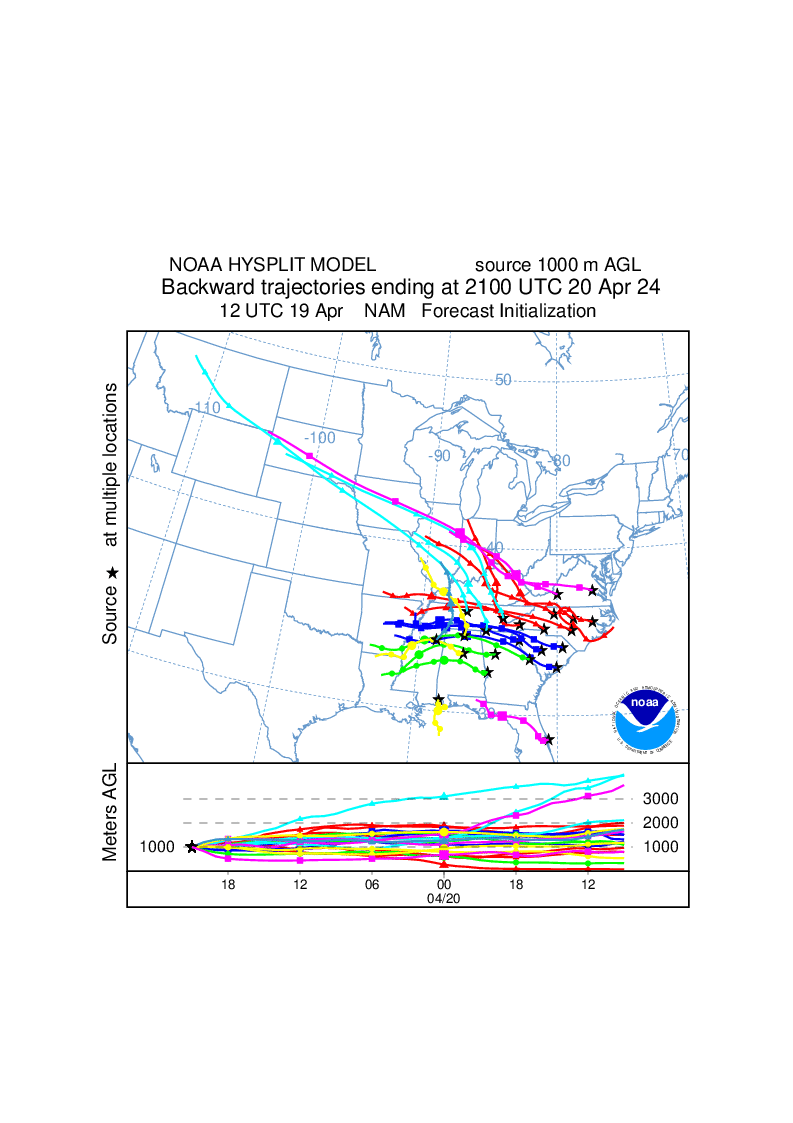
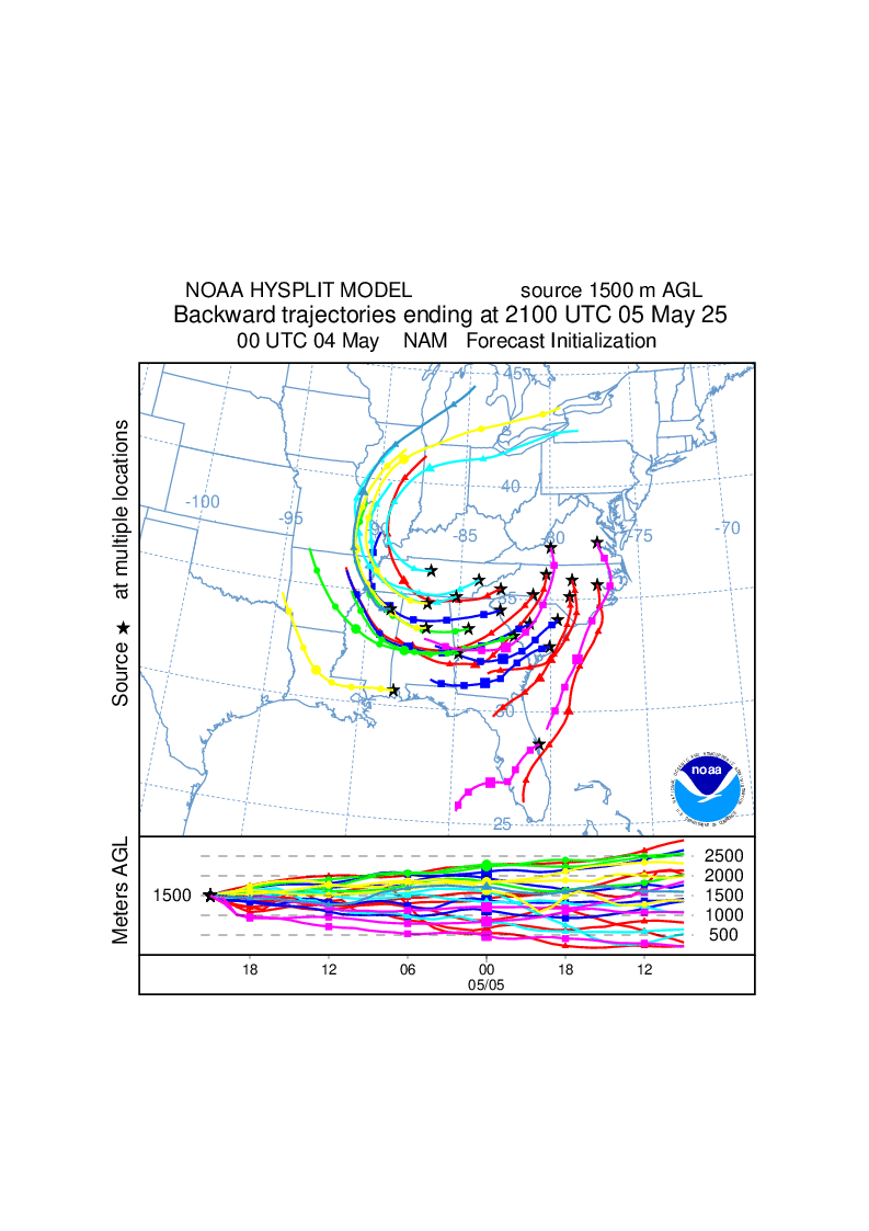
txt - Trajectory endpoints format help Forecast DetailsForecast trajectories for the Southeast U.S. and vicinity are summarized above. The 36-h duration backward trajectories begin at 21 UTC (4 pm EST) today and tomorrow at heights of 10 m, 500 m, 1000 m, and 1500 m above model ground level. The 18-h duration forward trajectories begin at 11 UTC (6 am EST) today and tomorrow at heights of 10 m, 500 m, 1000 m, and 1500 m above model ground level. The trajectories are computed using meteorological fields output from the NOAA National Centers for Environmental Prediction (NCEP) North American Mesoscale (NAM) forecast model. Model output from the latest 00, 06, 12 or 18 UTC NAM forecast are first used in the trajectory calculation, then, if necessary for the backward trajectories, short-term (up to 12 hours) NAM forecasts from previous run(s) are used. Details on the 12 km NAM gridded data used in these calculations are available on the forecast meteorology web page. Maps do not give the NAM model forecast initialization time if only short-term forecasts are used in the calculations. Trajectories in different states are shown in different colors (except for kml output). The trajectory endpoints are plotted on maps (gif & kml) and displayed in text files (txt). The trajectories originate at the following sites:
|
|||||||||||||||||||||||||||||||||||||||||||||||||||||||||||||||||||||||||||||||||||||||||||||||||||||||||||||||||||||||||||||||||||||||||||||||||||||||||||||||||||||||
|
|
|||||||||||||||||||||||||||||||||||||||||||||||||||||||||||||||||||||||||||||||||||||||||||||||||||||||||||||||||||||||||||||||||||||||||||||||||||||||||||||||||||||||
