
Forecast Trajectory Maps for the Mid-Atlantic United States Updated on Thu Jul 16 15:17:33 UTC 2026
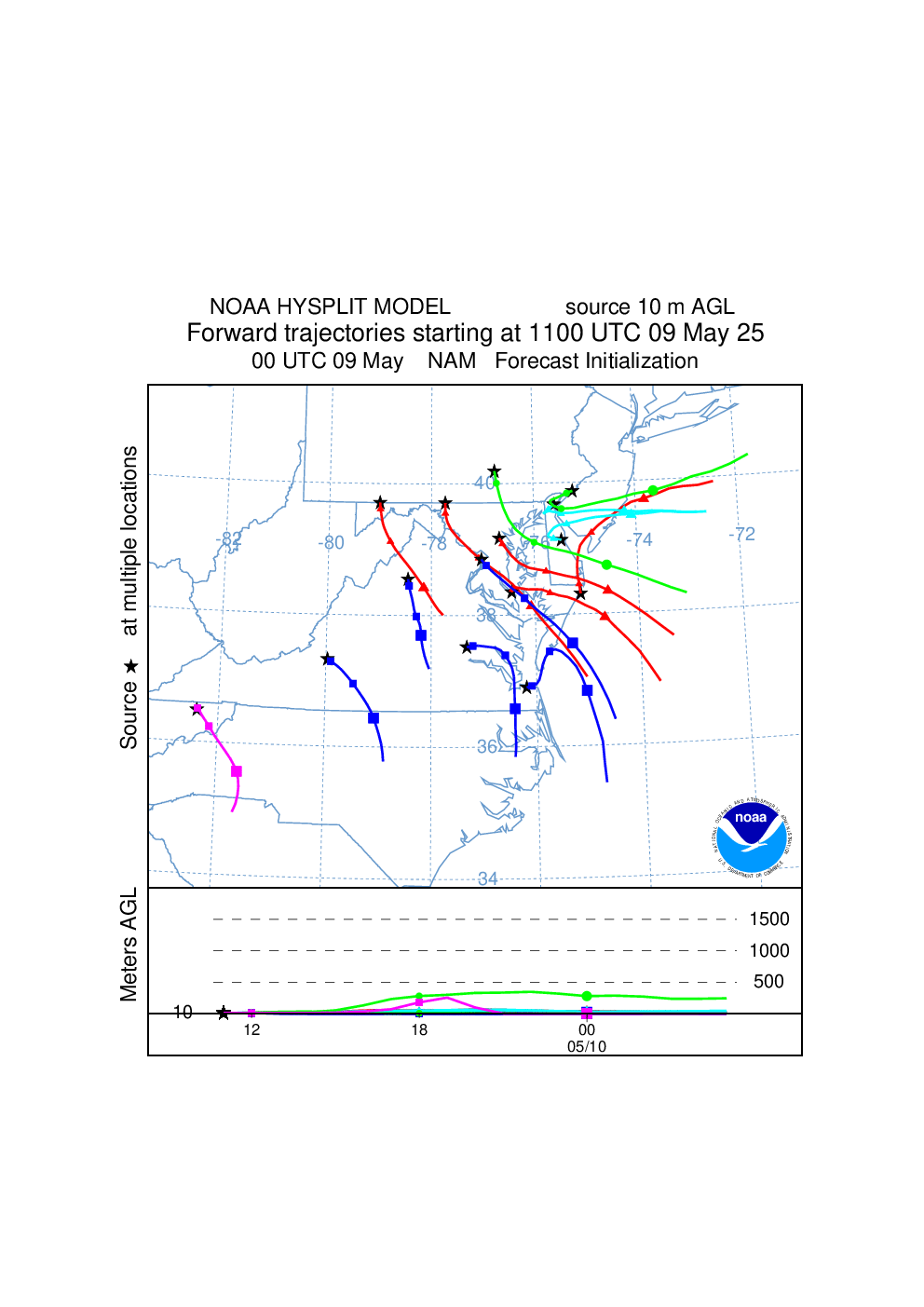
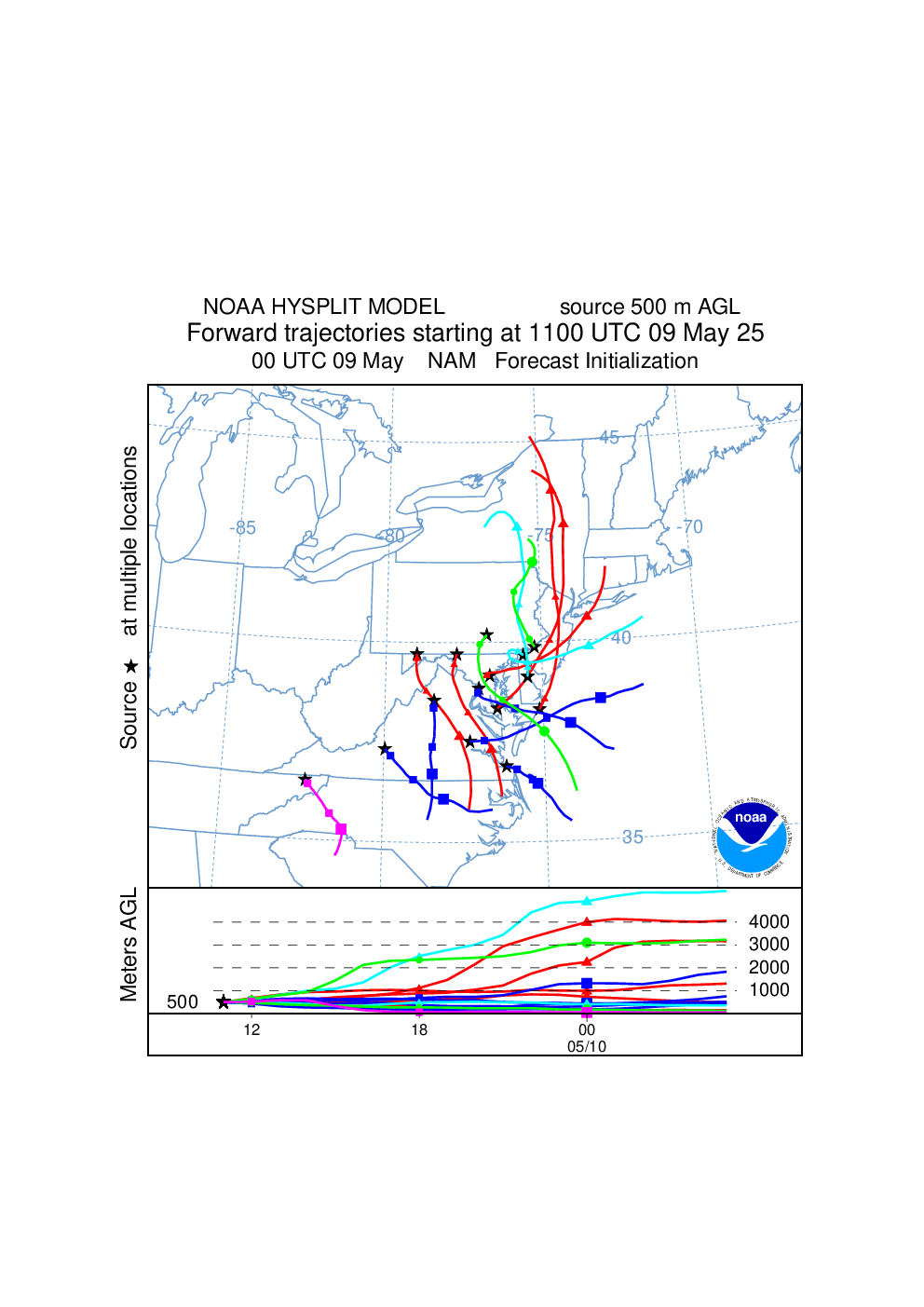
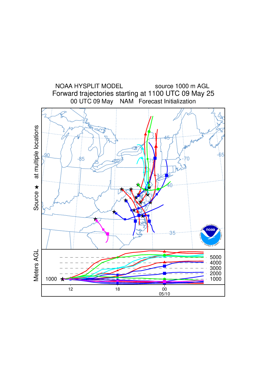
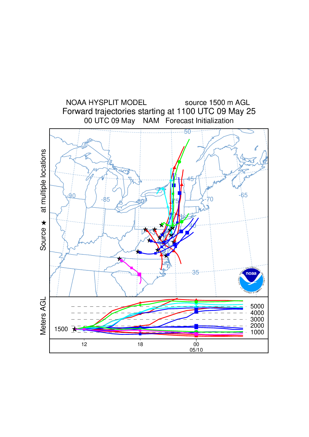
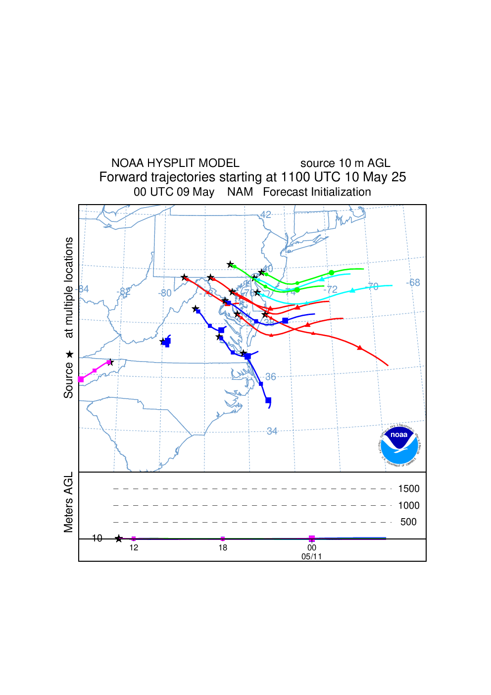
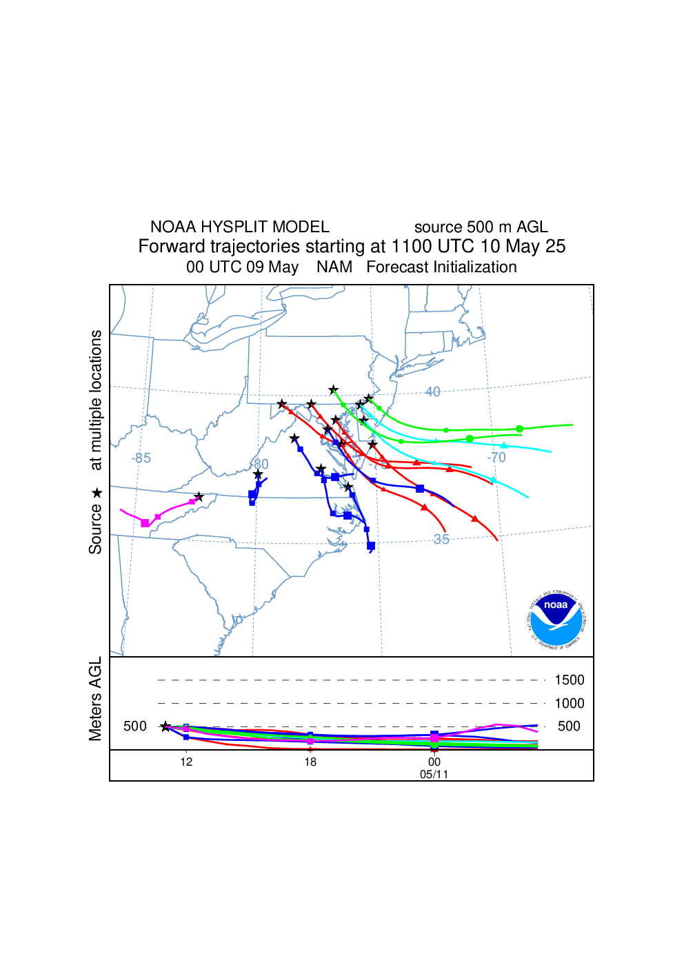
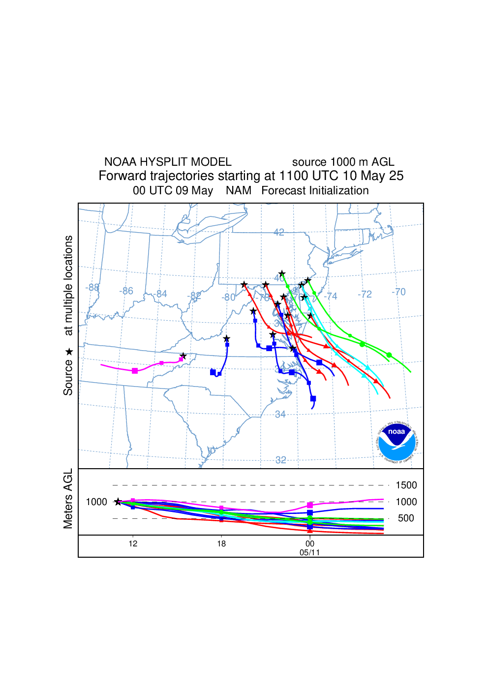
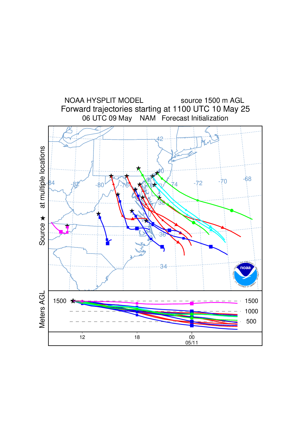
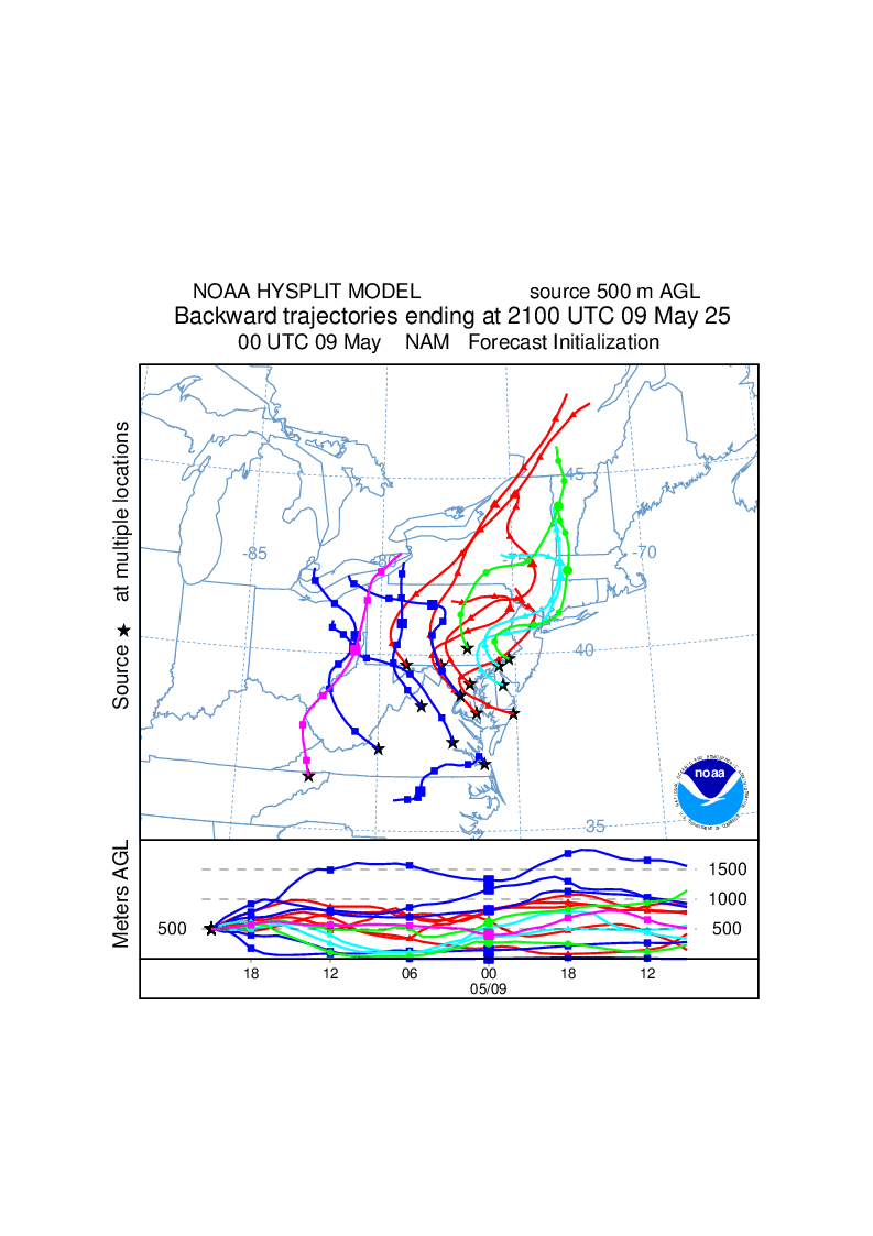
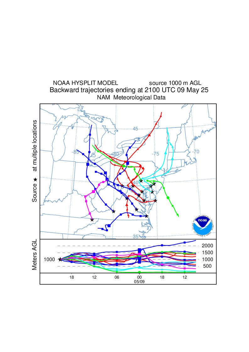
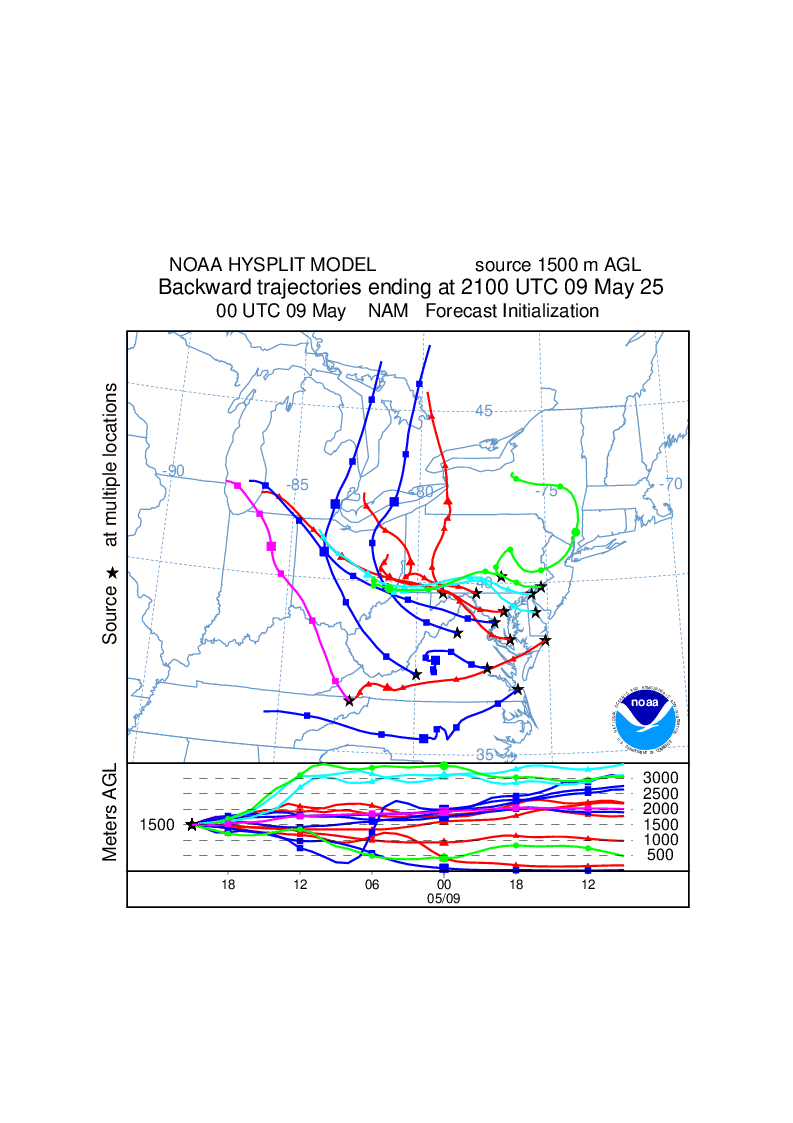
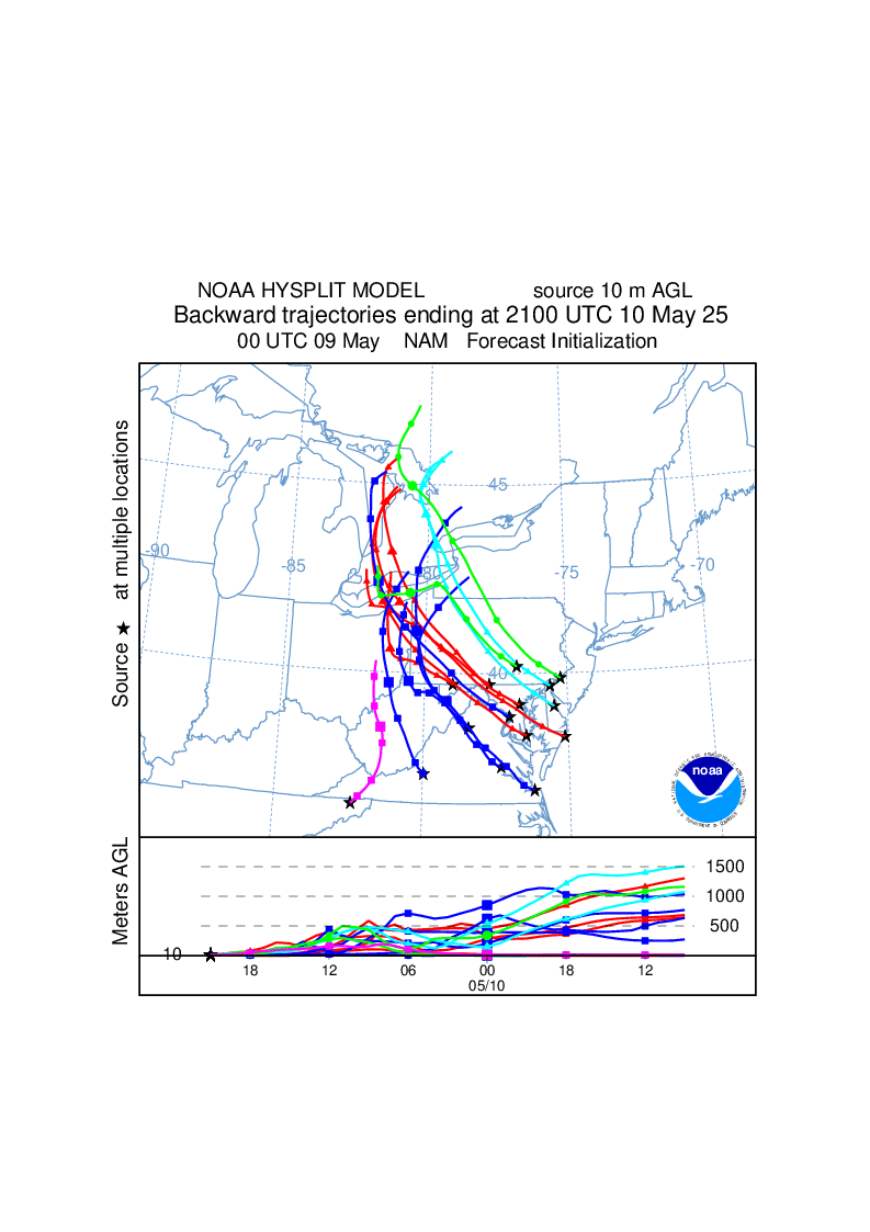
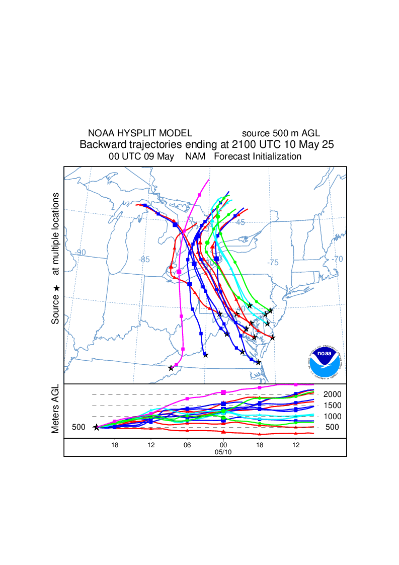
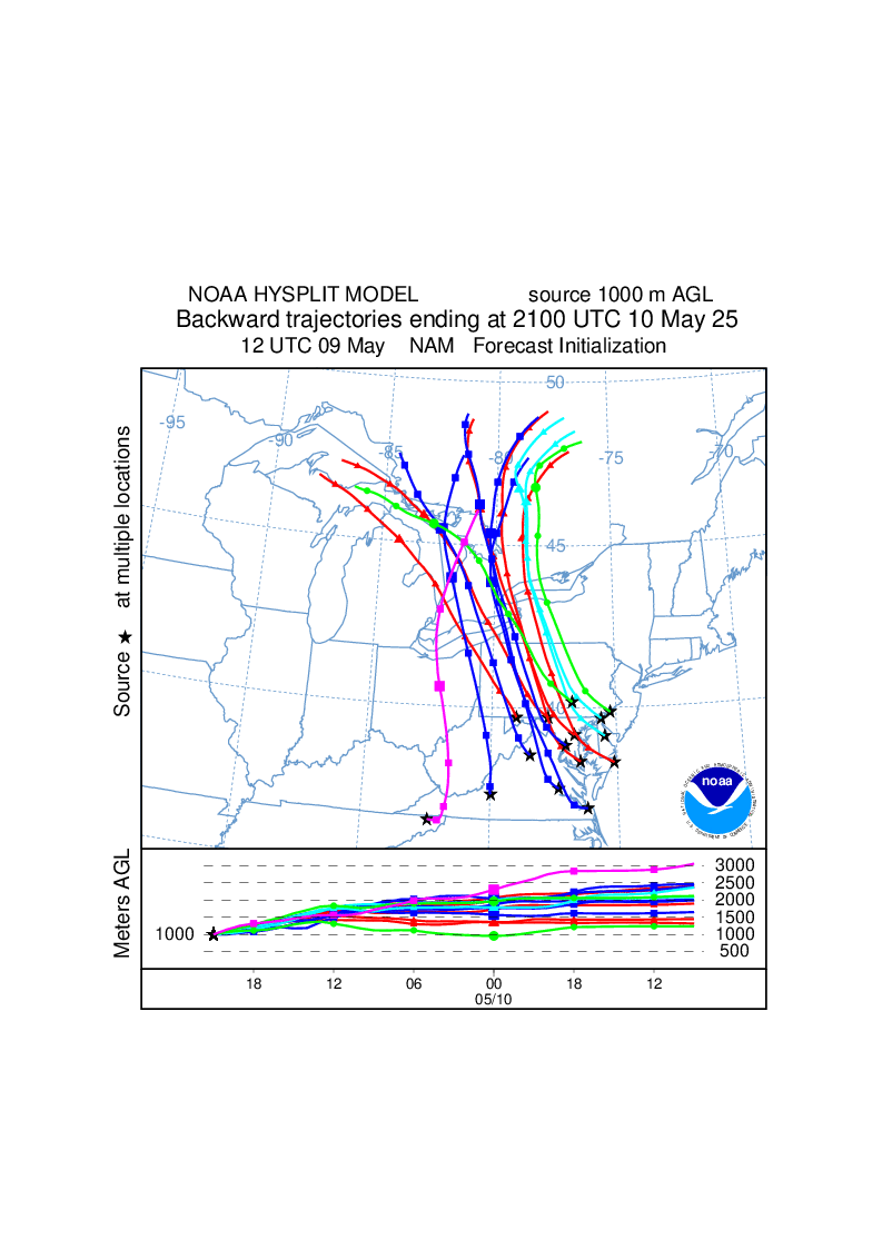
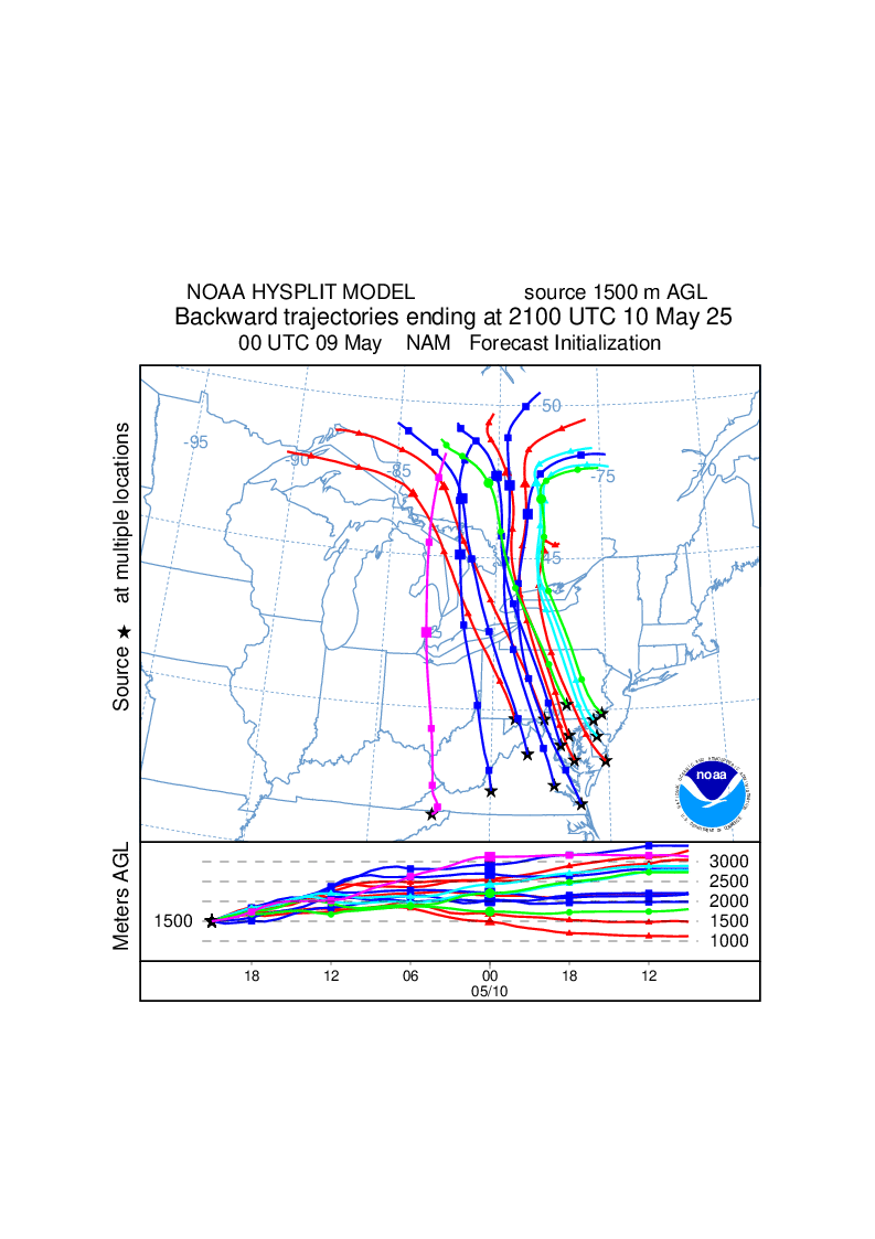
txt - Trajectory endpoints format help Forecast DetailsForecast trajectories for the Mid-Atlantic region are summarized above. The 36-hour duration backward trajectories originate at 21 GMT (4 pm EST) today and tomorrow at heights of 10 m, 500 m, 1000 m, and 1500 m above model ground level. The 18-hour duration forward trajectories originate at 11 UTC (6 am EST) today and tomorrow at heights of 10 m, 500 m, 1000 m, and 1500 m above model ground level. Model output from the latest 00, 06, 12 or 18 UTC NCEP North American Mesoscale (NAM) model forecast are first used in the trajectory calculation, then, if necessary for the backward trajectories, short-term (up to 12 hours) NAM forecasts from previous run(s) are used. Details on the 12 km NAM gridded data used in these calculations are available on the forecast meteorology web page. The trajectory endpoints are plotted on maps (gif & kml) and displayed in text files (txt). The trajectories originate at the following sites:
|
|||||||||||||||||||||||||||||||||||||||||||||||||||||||||||||||||||||||||||||||||||||||||||||||||||||||||||||||||||||||||||||||||||||||||||||||
|
|
|||||||||||||||||||||||||||||||||||||||||||||||||||||||||||||||||||||||||||||||||||||||||||||||||||||||||||||||||||||||||||||||||||||||||||||||
