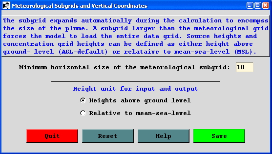
MGMIN (10) is the minimum size in grid units of the meteorological sub-grid. The sub-grid is set dynamically during the calculation and depends upon the horizontal distribution of end-points and the wind speed. Larger sub-grids than necessary will slow down the calculation by forcing the processing of meteorological data in regions where no transport or dispersion calculations are being performed. In some situations, such as when the computation is between meteorological data files that have no temporal overlap or insufficient spatial overlap, the model may try to reload meteorological data with a new sub-grid. This will result in a fatal error. One solution to this error would be to increase the minimum grid size larger than the meteorological grid to force a full-grid data load.
KMSL (0) sets the default for input heights to be relative to the terrain height of the meteorological model. Hence input heights are specified as AGL. Setting this parameter to "1" forces the model to subtract the local terrain height from source input heights before further processing. Hence input heights should be specified as relative to Mean Sea Level (MSL). In concentration simulations, the MSL option also forces the vertical concentration grid heights to be considered relative to mean sea level. The option to set the release height dynamically as a fraction of the mixed layer depth is not available for concentration-dispersion simulations.
