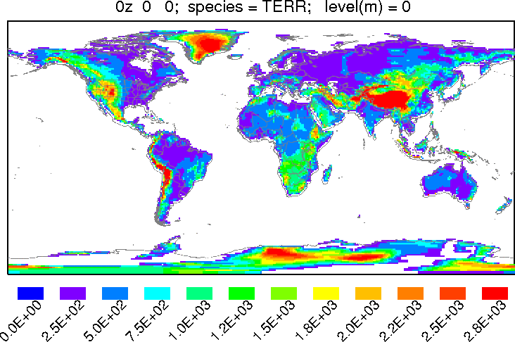
The bdyfiles subdirectory contains ASCII files for gridded land-use, terrain, and roughness length data for HYSPLIT. The terrain file is used by some of the programs in data2arl if the terrain is not provided with the other meteorological fields. The resolution for these files is one-degree covering the globe: 360 by 180 grid points. The upper left corner starts at 180W - 90N. If these files are not found, the model uses default constant values for land-use and roughness length.
The structure of these files is given in the ASCDATA.CFG file, which defines the grid system and gives the directory location of the land-use, terrain, and roughness length files. The ASCDATA.CFG file should be located in the model's startup or root directory. The last line in the file should be modified to reflect the path to the bdyfiles directory.
File Format
The ASCDATA.CFG file contains the following six records:These files may be replaced by higher resolution user created files. Note that the first data point on the first record is assumed to be centered at 179.5W and 89.5N, so that from the northwest corner the the data goes eastward and then southward. User supplied files should define roughness length (cm - F4) and the following land use-categories (I4). The record length of the file should be the number of longitude values times four bytes plus one additional byte for CR.
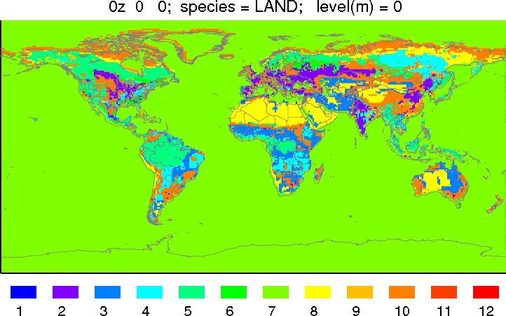
The 11 Land-Use Categories
The One-Degree Terrain