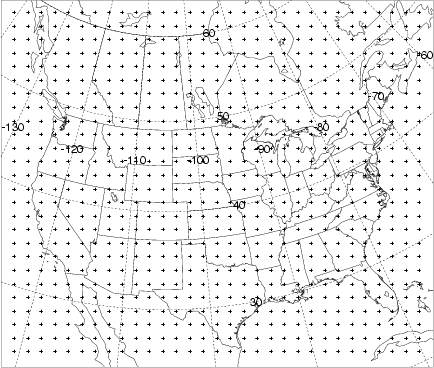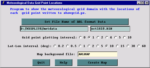
The showgrid program is used to show the domain of the ARL packed format meteorological grid file. Output is to an HTML file and contains a plus symbol at every grid point intersection as selected by the integer plotting increment. A non-zero value for the Lat-Lon interval draws latitude-longitude lines at that interval over the map background. The example below is shown for the sample meteorological data file.
The following graphic is produced: