Grid Resolution of User Entered Data
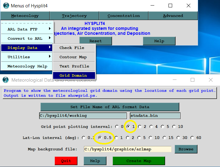
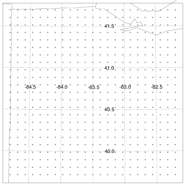
~11 grid points per degree latitude
~111 km per degree latitude
~10 km per grid point
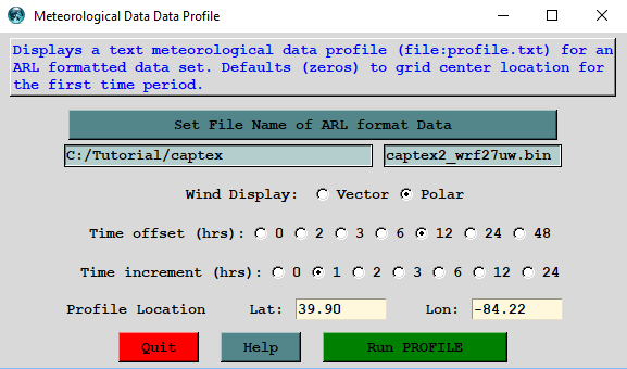
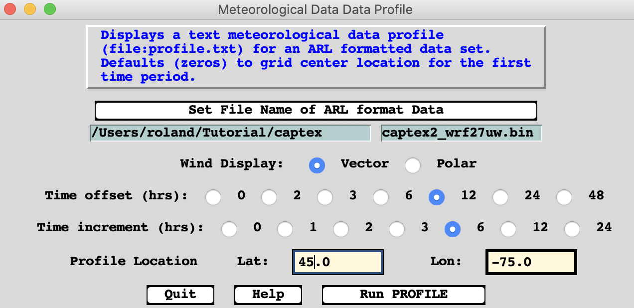
Profiles of WRF27uw
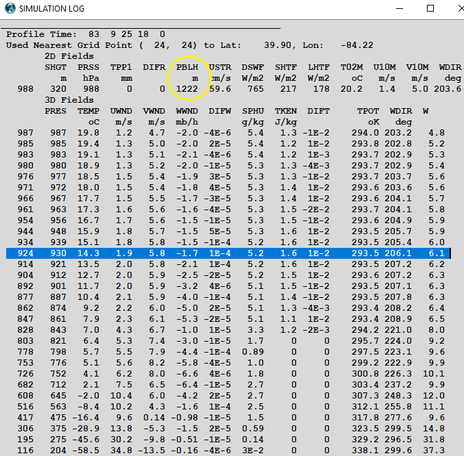
PBL = 1222 m AGL + 320 m MSL = 1542 m MSL
Profiles of WRF27
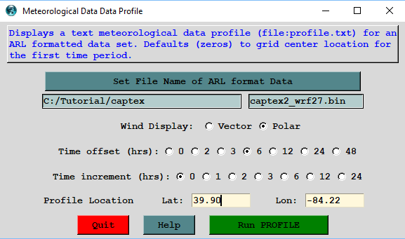
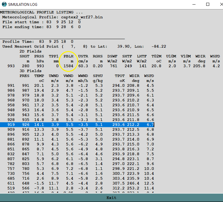
PBL = 1584 m AGL + 280 m MSL = 1864 m MSL
1800 UTC Sounding at Dayton:
PBL = 1600-1700 m MSL
Profiles of WRF27uw at 45°N 75°W at 1800 UTC
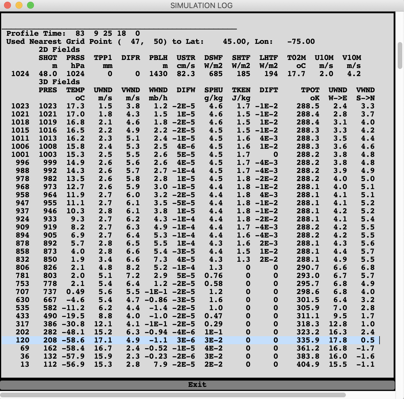
The true angle is 0.5/17.8 (57.3 deg/rad) = 1.6°
The grid angle is 4.9/17.1 (57.3 deg/rad) = 16.4°
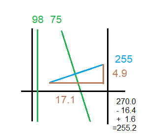
A west wind would appear as a 255° vector along the 75°W meridian
|